
Rural Iceland Revealed: Breathtaking Farms, Canyons, and Fjords Between Mývatn and Egilsstaðir
- sdhammond2
- Nov 10, 2025
- 4 min read

Unless you drive this route, you’d never truly see it. The northeast leg out of Mývatn takes you past the volcanic steam vents of Hverir, winding through some incredible farmland. Iceland may not be the first place you think of for farmland, but its agricultural system is deeply significant—rooted in unique geography, environmental advantages, and its important role in national independence. Despite harsh terrain, about 6% of Iceland's population still lives on farms, although this number is declining.
Geography and Agricultural Limits
Only about 1% of Iceland’s land is usable for agriculture due to volcanic terrain and subarctic climate. Farms are mostly located on green peripheral areas dominated by grasslands. The scarcity of arable land contributes to Iceland’s historic settlement patterns and the value of farmland.
Our Itinerary
This day was planned as a full exploration from Mývatn to Studlagil Canyon, then onward to Egilsstaðir for a late lunch at the lovely
Hotel Gistihúsið - Lake Hótel Egilsstaðir Later, we drove through spectacular landscapes to Seyðisfjörður for dinner and sightseeing, stopping along the way at a picturesque waterfall.
The Drive East
The drive from Mývatn to Studlagil Canyon is under two hours along the Ring Road and dotted with widely spaced, very scenic farms. I often wondered what life was like there in winter. A waitress we met later said that a neighbor once got lost on a snowy night and was found frozen days later. That story brought the harshness of the landscape into sharp focus.
Farms sit about a quarter mile off the Ring Road, on sweeping land that rises toward mountain highlands and fjords. At one point, the terrain looked almost otherworldly—like a scene from Star Trek—with fog drifting over the folds of rock and snow along the fjords. The cover photo I chose came from this area just before Egilsstaðir.

Arrival at Studlagil Canyon
Reliable information was scarce since Studlagil is a relatively new tourist site (still developing in 2023). There are two access points to the canyon:
West side: Just off the Ring Road, this leads onto a farmer’s land with a small rest area and platform. A long staircase descends toward the canyon, though this side doesn’t give access to the iconic basalt columns within the canyon.
East side: Requires driving further east to a different parking lot and crossing the river via a side road to hike into the canyon itself.
You can park at three spots: the bridge parking lot, a second parking lot accessed across the river, or a further dirt road leading to a larger lot near Studlafoss waterfall.
Hiking Studlagil Canyon
From the furthest parking lot, the hike is under 2 kilometers, walking through farmland along the river. Your first stop is Studlafoss, a basalt waterfall visually reminiscent of the famous Svartifoss waterfall.

The canyon hike — popular even in April — offers three classic photographic angles:
The ridge with thin basalt spires you can walk out on (though it gets crowded, much like Devil's Arch in Sedona).
Looking down the stone pathway along the slippery riverbank to capture the dramatic canyon depth.
Shooting up from the river’s edge to emphasize the immense height of the basalt columns.
The east side hike to Studlagil is about 2-3.5 miles round trip, mostly easy with some slippery rock sections

Egilsstaðir
After the hike, it’s back on the Ring Road for a short drive to Egilsstaðir, a charming European-style town situated on the tip of a lake with splendid views of mountains and fjords. We stayed at the Lake Hotel Egilsstaðir, a tasteful spot with a spa and great restaurant, where American Express points were well worth redeeming. The hotel offers cross-country skis and a boathouse by the lake, perfect for morning photography.
Lunch was at the hotel restaurant—my wife’s lamb with carrots and beetroot salad was outstanding, while my simple hamburger was surprisingly delicious.
Seyðisfjörður
Next, we drove to the quaint port town of Seyðisfjörður. En route, we stopped at Gufufoss, an easy-access waterfall along Route 93 with excellent photographic opportunities. The drive down the fjord to the port was breathtaking and not too long.

Seyðisfjörður’s compact main street, famous for its rainbow-colored houses and the beautiful Blue Church Seyðisfjarðarkirkja is a dreamy spot at sunset.
Dinner at Kaffi Lára El Grillo Bar was lively and delightful. The locals were warm, the ambiance inviting, and the food excellent.
The ride back to the hotel was magical, with snow falling heavily as we ascended back up the fjord. We even learned about a snowmobile race happening up on the glacier the next day, a perfect cap to a lovely, full day.

Additional Suggestions for This Leg:
Site/Attraction | Description | URL |
Húsavík Whale Watching | Renowned whale watching town, north of Mývatn | |
Ásbyrgi Canyon | Horseshoe-shaped canyon and hiking area north of Mývatn | |
Jökulsárgljúfur National Park | Rugged landscape near Studlagil and Ásbyrgi | |
Djúpivogur | Charming fishing village on the way south after Egilsstaðir |
👉 Next up: East Iceland Odyssey: Fjords, Fishing Villages, and the Dramatic Vestrahorn Coastline
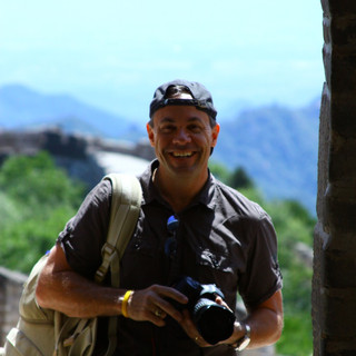
Join me on this journey, and let's explore the world through the lens of my camera together.
Also, please visit: FineArt America - Steve Hammond


Comments